
When Mansa Musa, ruler of the Mali Empire, travelled to Mecca in 1324, his route crossed a network that joined West Africa to North Africa and the wider Islamic world. The journey is often remembered through one dramatic detail: the gold he distributed in Cairo. Yet the pilgrimage mattered for more than a story about wealth. It made visible the roads, scholars, merchants and political relationships that connected Mali to other centres of power.
Much of what is known about the Cairo visit comes from the fourteenth-century Egyptian writer al-Umari, who gathered accounts from people who had seen the caravan. Boston University’s African Studies Center presents his description as a near-contemporary source, while also reminding readers that it was recorded after the event. Historians use such accounts carefully, comparing them with other evidence rather than treating every memorable anecdote as an exact measure.
A pilgrimage across trade routes
Musa’s journey moved along trans-Saharan routes used by traders, scholars and pilgrims. Mali’s position connected the goldfields and salt-producing regions of West Africa with markets in North Africa and the Mediterranean. The empire did not need to control every mine or caravan to benefit from that movement. Its authority over routes and exchange helped make Mali wealthy and politically influential.
In Cairo, the caravan’s gifts and spending drew attention. Later writers described disruptions in the value of gold, an anecdote that helped build Musa’s reputation across centuries. It is difficult to convert that account into a precise economic measure. The story should not be turned into a modern ranking of who was “the richest person ever.” Medieval wealth cannot be compared cleanly with present-day assets, and the historical evidence does not provide an audited balance sheet.
How a map carried his image
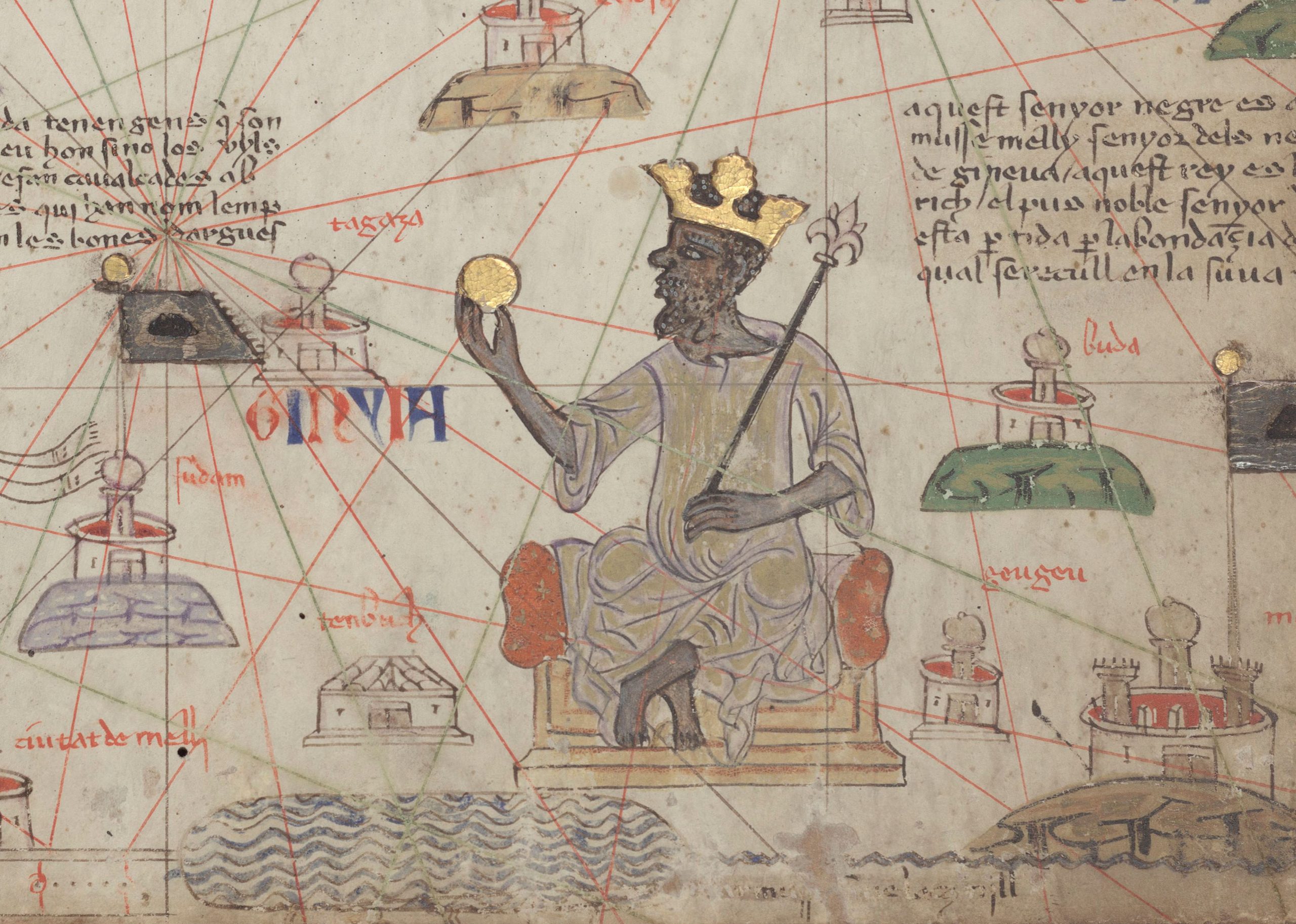
About fifty years after the pilgrimage, the Catalan Atlas made in 1375 depicted Musa seated with a gold coin in his hand. The map was created in Majorca and preserved a European view of West African geography and power. Musa’s image became a visual statement that Mali belonged on the mental map of a wider world.
The atlas was not a photograph or a neutral map. It combined geographic information with artistic signs of wealth and authority. Its portrait tells us how a distant cartographer represented the ruler, while local architecture, Arabic writing and oral traditions preserve different parts of Mali’s history.
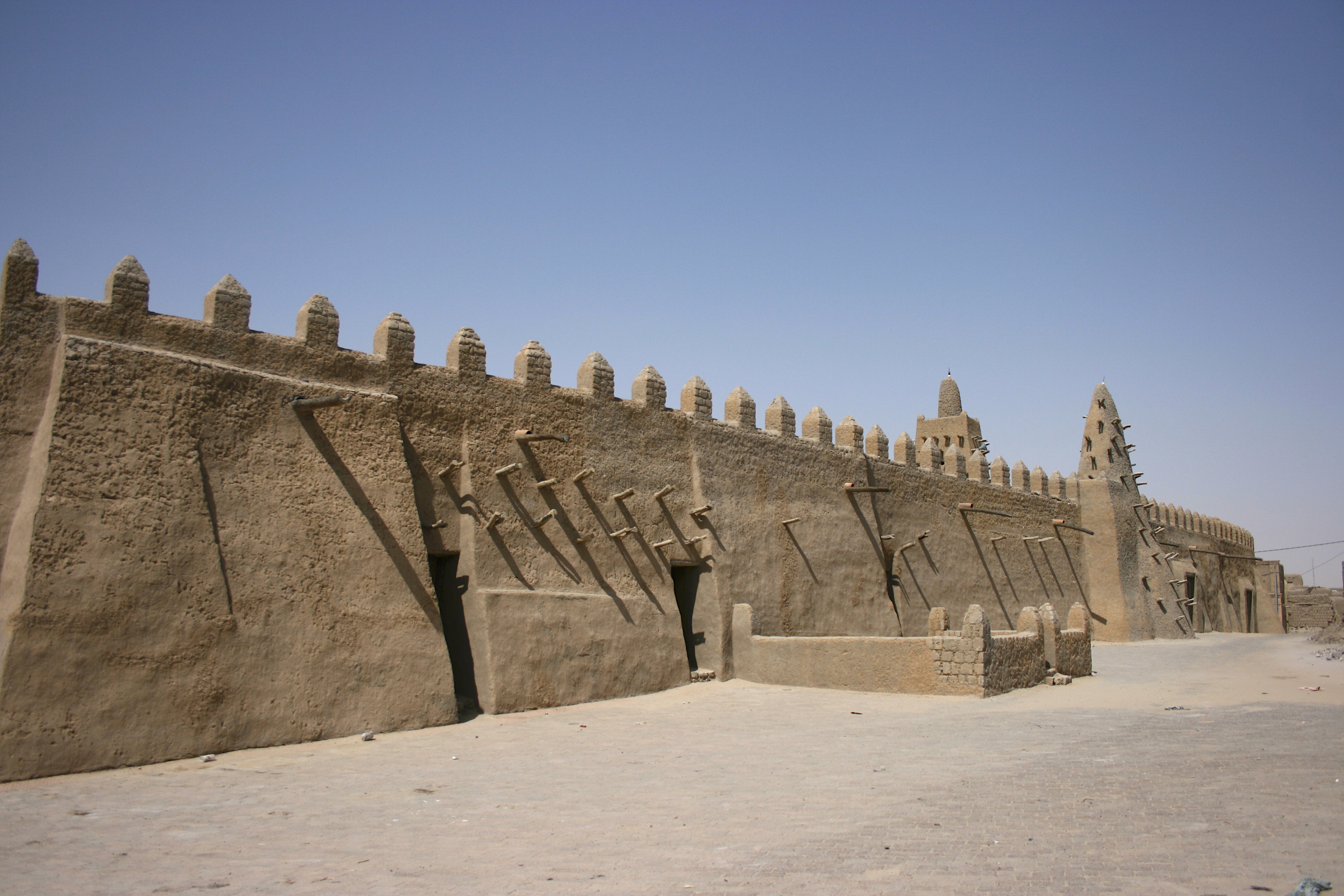
The mosque in Timbuktu commonly associated with Musa’s reign points to another dimension of that legacy: the movement of builders, scholars and ideas. The exact histories of individual structures are complex, but the region’s centres of worship and learning grew within a society tied to trade and religious exchange. Musa’s pilgrimage is remembered because it joined these worlds in a visible way. The journey did not create Mali’s importance. It made the empire’s connections harder for others to ignore.
Sources
- Boston University’s source notes on al-Umari
- The Met on trans-Saharan gold networks
- The Met on Mansa Musa in the Catalan Atlas
Image credits
Cover image: Abraham Cresques, Catalan Atlas, 1375, public domain reproduction via Wikimedia Commons. In-article image: Mamadou Cissé, CC BY-SA 4.0, via Wikimedia Commons.
The conversation
0 comments
Join the discussion with a thoughtful response.