
When a river takes a road in the Niger Delta, the most valuable photograph may be the one taken yesterday. A rescue team needs to know where the road used to run, which approach is still dry and whether the dark patch on this morning's image is floodwater or a perfectly ordinary creek. A beautiful photograph of the entire planet is of limited comfort to the driver who has to turn left or right. The promise behind ECOSAT-1 begins with that driver. Can West Africa decide for itself what to photograph, how soon to photograph it and who gets the answer?
In Abuja on November 18, Nigeria's space agency unveiled a three dimensional printed model of a proposed regional Earth observation satellite. At a technical meeting scheduled through November 20, specialists from the Economic Community of West African States examined the design that the ECOSAT-1 model represents. NASRDA, Nigeria's National Space Research and Development Agency, carried out the technical study. The next political decision belongs to the region's science and technology ministers. A launch date, a funded construction contract and an operational service are three separate pieces of news that the unveiling did not supply.
That distinction makes the story more interesting. By the time a rocket leaves the ground, someone has already decided whose coastline matters, which rivers deserve repeat visits, what detail is worth paying for and how much delay a user will tolerate. Those decisions are much harder to photograph than a rocket. They also determine whether taxpayers will ever have reason to remember its name.
What Abuja decided about ECOSAT-1
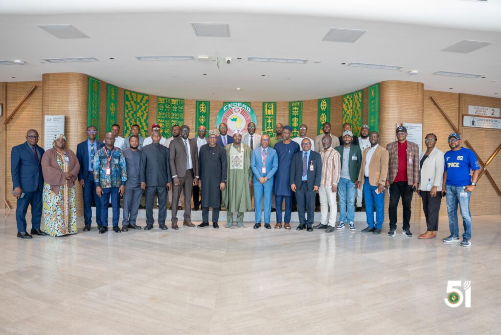
Professor Matthew Olumide Adepoju, head of NASRDA, presented the model to ECOWAS Commissioner Nassirou Bako-Arifari. The Commission's account put the exercise in a sequence that stretches back to a ministerial recommendation in Cotonou in December 2018. A study in 2023 identified what member states needed. The subsequent engineering work translated those needs into proposed specifications. In everyday terms, the first exercise asked which jobs needed doing. The second asked what sort of machine, people and ground facilities could reasonably do them.
The two questions can produce awkward answers for one another. An agricultural ministry wants repeated pictures of a vast area. A town planner may want one exceptionally detailed view of a much smaller area. An emergency service wants a picture now. A university might gladly wait several weeks for a carefully checked archive spanning a decade. Each is making a sensible request. Give them the same satellite and they have to decide who gets priority, including on the unfortunate afternoon when several of them have excellent claims at once.
The public accounts also differ slightly in their timing. Specialist publication Space in Africa reported that experts validated the study. The Commission's November 19 statement described consolidation and validation as expected outcomes of the three day proceedings. Both accounts put ECOSAT-1 at the design review stage. Neither constitutes ministerial adoption. For anyone following the money or trying to forecast when images will arrive, the document to watch is the ministers' decision and the implementation commitments attached to it.
Two cameras for two different kinds of question
The proposed ECOSAT-1 payload makes the competing demands unusually easy to understand. According to the technical details reported by Space in Africa, one instrument would take in a strip roughly 19.5 kilometres wide at fine resolution. The other would cover about 392 kilometres across at a resolution of ten metres. Imagine looking out over a market square. One moment you want to know which stall has pulled down its shutters. The next you want to know whether traffic has backed up all the way to the expressway. You would change where, and how closely, you looked.
For the narrower ECOSAT-1 instrument the reported design targets are half a metre for panchromatic imagery and one metre for multispectral imagery. Panchromatic describes a measurement that gathers a broad band of light into one brightness value. A multispectral instrument distinguishes several bands. The difference matters because two surfaces that appear equally bright in a grey picture may reflect light very differently across those bands. More detail about shape and more information about materials are both desirable. They are also different kinds of information.
There is a small trap in the phrase half a metre. A pixel representing a patch roughly that size on the ground does not promise that everything half a metre wide will be recognisable. Contrast matters. So do haze, shadows, viewing angle and the quality of the processing. A white roof on dark soil announces itself quite differently from an unpainted object against a similarly coloured road. A journalist looking at a thin line in a picture should still ask the engineer how confidently that line can be identified before deciding it is a broken bridge.
The two proposed ECOSAT-1 views suggest a practical division of labour. The wide view could help analysts find the sections of a basin where something has changed. The narrow view could focus attention on a few places where the consequences matter most. The engineer has just bought the editorial desk a useful word, namely “could”. The result depends on the spacecraft passing at the right time, clear enough conditions, a successful acquisition and somebody on the ground being available to interpret it. Space photography is extraordinarily capable. It also keeps appointments according to orbital mechanics.
The value of yesterday's picture
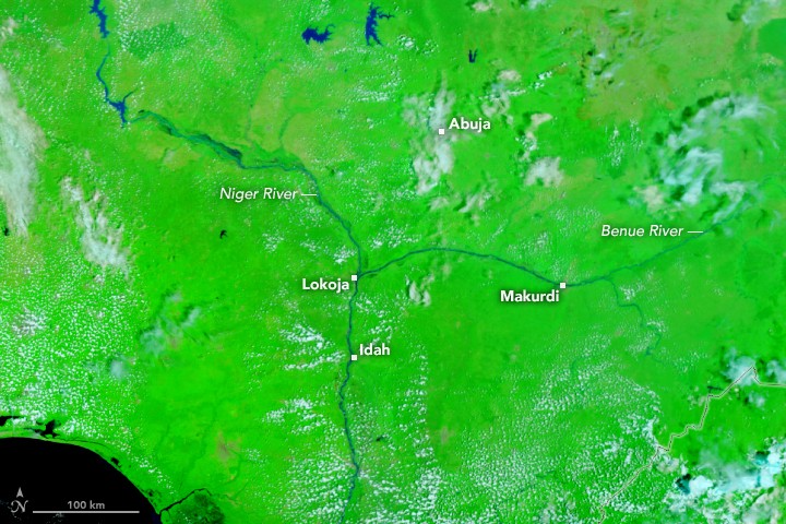
Consider a hypothetical flood desk with two images and one telephone call to make. The first picture shows a wide stretch of brown water. The second, taken earlier in the season, shows water in much of the same area. Comparing them reveals a narrow tongue extending beyond its usual boundary. On a local road map that tongue crosses the only direct route to a clinic. Now the desk has a specific question for a person nearby. Is the culvert carrying the flow, or is the road already under water?
Without the older image, a perfectly capable analyst might spend hours investigating a body of water that local residents could identify before breakfast. Without the local call, that same analyst might tell an ambulance to avoid a road that is still passable. Good observation depends on putting different forms of knowledge together. A satellite gives the emergency desk reach. People who live nearby give it context. Neither has to surrender its particular authority for the combination to work.
Time stamps deserve as much prominence as colourful maps. An image delivered this afternoon may have been acquired yesterday morning. A map published at six might contain a river boundary inferred from observations at noon. A resident opening either product on a phone during heavy rain deserves to know which clock is running. An age label, a legend that survives a screenshot and a phone number for reporting changes could be more useful in practice than an impressive increase in the resolution of the background photograph.
This is also where open archives earn their keep. A set of images becomes more valuable when the same places can be compared across seasons and years. A river has dry weather habits, rainy weather habits and occasional surprises that make sense only against a much longer record. A service that charges little for a new picture but makes its older pictures difficult to search has quietly made each new picture less informative. Archive policy sounds like a subject designed to empty a conference room. Ask anyone trying to reconstruct the last flood.
How a farm comes to look different from space
Agriculture offers a second test. Take two neighbouring fields that return different signals to the sensor. An analyst might suspect differences in crop cover or growth. The temptation is to colour one field green, the other amber, and let a dashboard pretend the difficult part is over. A farmer will promptly supply the awkward questions. Were the fields planted the same week? Do they contain the same crop? Was one harvested yesterday? Did a shower fall on one part of the district and miss the other?
An ECOSAT-1 agricultural service would record the uncertainty and send the local extension officer somewhere worth visiting. It might reveal that a group of fields has departed from its usual pattern. If officers find a common problem on the ground, the wider image can then help them decide where else to look. In that sequence the satellite saves travel time and improves the questions asked on arrival. It has achieved something more useful than producing a dramatic colour for a ministerial presentation.
There is an equity question hidden in the shape of the fields. A ten metre square covers one hundred square metres. Where plots are small, irregular or planted with more than one crop, a single measurement can contain several different surfaces. The neat blocks visible in a brochure may bear little resemblance to the agricultural landscape a regional service is supposed to serve. A product trained and tested principally on large uniform fields could look excellent in a demonstration and disappoint the growers whose needs helped justify the programme.
A sensible trial would invite farmers and extension workers to examine examples of both success and failure. Show them the place where the alert was right and the place where the algorithm was confidently wrong. Ask which difference would have changed a decision. Would three days' notice help? Does a message need to be sent in a local language? Is there anybody with transport to investigate? The answer may point to an unglamorous expenditure on motorcycles or communications. That is an excellent outcome for a space programme whose purpose is agriculture.
The coast presents a different challenge
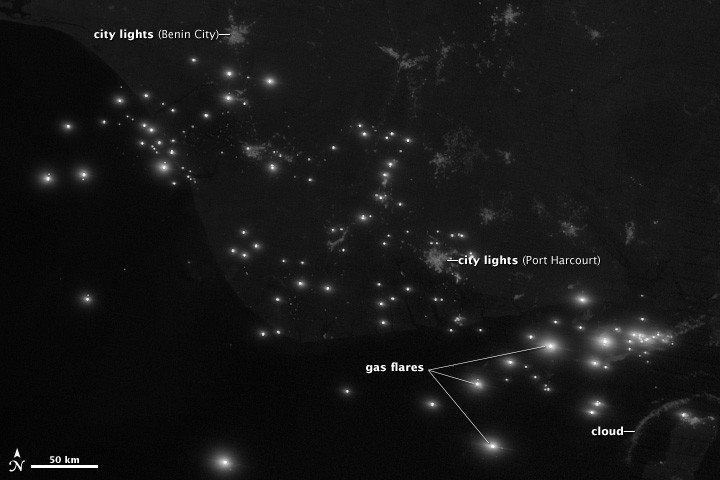
A shoreline looks like a line until somebody tries to measure it. Waves, tides, wet sand and shadows change what an instrument sees. Compare two pictures taken at different points in a tidal cycle and the apparent edge of the land may shift even where there has been no lasting erosion. Put houses, roads and livelihoods close to that edge and the difference between a temporary waterline and a retreating coast becomes a matter of public consequence.
For coastal communities a useful archive would preserve the circumstances of observation alongside each picture. Measurements made under comparable conditions would help identify places that require closer investigation. A local survey could establish what is actually happening to the land. Engineers could then test a proposed intervention against a record that extends beyond one spectacular storm. A satellite can make gradual changes visible to people whose budgets and political terms often encourage them to pay attention only after a crisis.
Adepoju also raised illegal fishing as a regional concern. Observation can indicate that a vessel was present in a particular place when a picture was taken. Establishing who operated it, what permission it held and what it was doing requires other evidence. An official deciding whether a picture justifies further investigation has a different job from a court deciding a case. A credible data service would make that difference plain through its documentation, especially where people might otherwise mistake an attractive map for a verdict.
There is an important public benefit even when no enforcement action follows. Coastal authorities can compare patterns of activity, direct scarce inspection resources and discover gaps in their own coverage. Operators who comply with the rules also have an interest in reliable information. False certainty consumes the time of the innocent and gives the genuinely suspicious activity somewhere to hide in the noise. Better observation should make the administration more discerning. Simply giving it a sharper pair of eyes will not settle what it ought to conclude.
Who gets to ask the spacecraft a question?

Data sovereignty sounds formidable until an emergency brings it down to earth. Suppose two countries want the narrow camera over different places during the same opportunity. Who decides? Are neighbouring emergency authorities allowed to request images directly? Does a request from a ministry displace a scheduled scientific observation? Can a university publish an embarrassing finding without negotiating a second round of permissions? These are practical meanings of ownership that cannot be settled by painting a regional emblem on a spacecraft.
The answer may reasonably differ by product. A basic map of last month's vegetation could be openly downloadable. A detailed image acquired during a sensitive emergency might require restricted access for a time. If the rules are published before the emergency, participants can argue about them while everyone still has the luxury of patience. If they are invented in the middle of the emergency, the people with the best connections are likely to get an answer before the people with the greatest need.
ECOSAT-1 also needs to work for institutions of quite different sizes. A well funded agency can download large data files, employ image analysts and run its own software. A small planning office may have one computer and a connection that slows to a crawl in the afternoon. Giving both an identical download link is formally equal and practically absurd. A smaller map, a low bandwidth alert and a help desk staffed by someone who understands the application can make a shared investment genuinely accessible.
Language deserves a place in that calculation. A map key, a warning and a training manual have to be understood by the people expected to act. Technical teams can agree on standard fields and still deliver plain language descriptions adapted to the receiving office. In a time critical bulletin, a clear statement of where the observation is uncertain is part of the product itself. The satellite will never learn whether its perfectly transmitted warning was quietly misread at a desk. Somebody on the ECOSAT-1 team must take responsibility for finding out.
A great deal of a space mission stays on the ground
ECOSAT-1 ground receiving stations were on the Abuja agenda. It is easy to look past them because the spacecraft occupies the imagination so completely. Yet each useful image has to travel through a chain of equipment and decisions. The observation is requested, scheduled, acquired, transmitted, processed, checked, stored and delivered. If the last three steps take too long, an image captured exactly on schedule may still arrive too late to answer the question that prompted it.
One measure worth publishing would be elapsed time from an emergency request to a usable product at the requesting office. Break that figure into its component parts and managers can see where money would help. A long wait for an orbital pass points to one problem. A picture sitting on a server awaiting an authorised signature points to another. The second can sometimes be fixed for the price of a meeting, provided the right people attend and agree to give up a little control.
Staffing makes another difference that a photograph of a ground station cannot show. An institution may own an antenna and depend on one engineer who knows how to recover it after an interruption. A university may produce excellent graduates who find the work interesting but the employment contracts too uncertain to remain. The ECOSAT-1 training plan deserves questions about second shifts, succession, training materials, documentation and salaries. These determine whether the ECOSAT-1 service still functions on the wet Sunday morning when the most experienced person is away.
Technical independence can also mean having the knowledge to choose partners well. Existing international missions, freely available datasets and commercial imagery can all contribute to a regional service. If cloud obscures a particular observation, another source may fill the gap. If a regional instrument supplies a valuable picture, exchanging it with a partner can improve both archives. The useful distinction is between having choices and being entirely at the mercy of someone else's schedule. Independence does not require a region to turn down a good photograph because it came from abroad.
What the ECOSAT-1 budget should buy
Space in Africa reports a design target of about 400 kilograms, a proposed orbit around 520 kilometres high and an intended working life of seven years. Treat those figures as planning assumptions. A design can change during financing, manufacture and testing. A spacecraft may work for a different period once it reaches orbit. What matters now is whether the ECOSAT-1 business case includes the entire period in which the service is supposed to deliver value, together with the cost of dealing with interruptions.
A budget that counts the spacecraft and its ride into space has paid for only part of the undertaking. Processing, communications, calibration, insurance where applicable, staffing and maintenance continue after the applause. Even the apparently mundane question of retaining copies of the archive in different places has a price. At the other end of the mission there is the question of continuity. A coastal erosion programme that depends on a long record cannot pause indefinitely while officials begin thinking about a successor.
There are ways of establishing value before ECOSAT-1 flies. Pick a real public service, agree on an operational question and attempt to answer it using imagery already available. Record the costs, delays and mistakes. Invite the eventual users to judge whether the answer helped. That trial creates a baseline against which the proposed regional capability can be assessed. It could reveal that a particular office chiefly needs faster analysis, or that an important region lacks the repeated observations required. Either finding would make the subsequent investment more intelligent.
It would also give the public something more informative than a promise about jobs. What work will take place in regional institutions? Which skills will employees practise often enough to retain? Who will own the documentation? Can another team maintain the software after the original contractor leaves? A programme that answers those questions candidly can create lasting technical experience even when some components must be acquired elsewhere. What remains after the purchase often matters more than which name appears on the delivery note.
The next announcement worth reading
Watch for a ministerial decision, an identifiable source of funds and an implementation timetable with accountable institutions. Look for ground station arrangements, procurement milestones and a public explanation of who will be able to obtain which products. When testing begins, ask what counts as a successful observation and who gets to judge. The answers should become more specific as the programme advances. A proposed satellite that promises to help almost everybody will eventually have to be excellent at a smaller number of real tasks.
West Africa has put a regional design on the table and given people a model they can inspect. That is a meaningful achievement in a field where the right to set the questions has economic and political value. The next achievement will be harder to stage for the cameras. One day a local official may receive a reliable, time stamped map, call the person who knows the road and send a vehicle by a safer route. If ECOSAT-1 helps make that sequence ordinary, the photograph from Abuja will have earned its place in the archive.
Reporting sources include the ECOWAS Commission’s November 19 account, NASRDA’s briefing and Space in Africa’s technical reporting.
Follow more reporting in Astra Planet’s Space section.
[…] See ESA’s first images and animation, EUMETSAT’s image record and Astra Planet’s companion feature on ECOSAT-1. […]